River Basin or Political Border: How to Compare the Maps
Compare a river basin or political border map to trace shared water, locate authority and spot where drainage systems cross jurisdictional lines.
The common mistake with river maps is treating the blue line as the whole story. A river basin or political border map can show how water connects places that are governed separately, and where boundaries divide people who share a flow. Without comparing them, a map’s neat edges can hide the links between upstream decisions, downstream communities and the landscapes between.
Follow the basin
A watershed, or drainage basin, is the land where rain and melting snow drain towards a shared outlet. Its boundary is usually a ridge: water falling on one side tends to flow towards one river system, and water on the other side towards another. The basin groups land by the direction water travels, not by who owns or administers it.
That grouping brings upstream and downstream places into one view. A tributary, wetland, reservoir and main channel belong to the same drainage network, even when they are far apart. The basin map helps you ask where water comes from, which routes it follows and which communities may depend on them.
It is not a complete account of every movement of water. Water can soak into soil, evaporate, be stored in snow or move through groundwater before reaching a channel. A watershed boundary is a useful organising line, not a claim that all water follows the visible surface network.
Locate jurisdiction
A political map sorts territory by authority. Depending on its scale and purpose, it may mark national, provincial, regional or municipal boundaries. These lines help locate who is responsible for land-use rules, public services, infrastructure and water-management decisions.
Political borders rarely follow ridgelines. One basin may cross several jurisdictions, while one jurisdiction may contain parts of several basins. The mismatch matters because the maps answer different questions: where will water tend to flow, and who can make decisions in a particular place?
If a river crosses a national or provincial boundary, decisions made upstream can affect downstream water users. A political map identifies the territories and authorities involved; it does not explain their policies, agreements or outcomes. Those require other sources, such as water-management documents or local records.
Compare map layers
To compare the maps, use two maps of the same area and check that their dates and coverage are suitable for your question. A printed map, a GIS viewer or a mapping tool with layer controls can all work. Treat the basin boundary and political boundaries as separate layers, much like two transparent sheets on a desk: each marks a different kind of connection.
- Check the basin map’s legend for whether it shows surface drainage, groundwater or a planning area. If the definition is unclear, find a map that states its scope before drawing conclusions.
- Check the political map’s legend for the level of government shown. If municipal responsibility matters but only provincial borders appear, use a more detailed jurisdiction map.
- Check that both maps cover the same places. If one leaves out the upstream headwaters or downstream outlet, choose maps with matching coverage before comparing routes.
- Check the dates and map purposes. If the boundaries come from different planning periods or definitions, treat apparent mismatches as uncertain and seek a consistent source.
- Mark where the basin crosses a political boundary. If the crossing is clear, note the jurisdictions on both sides; if it is obscured by scale or labels, consult a more detailed map.
- Check whether tributaries, reservoirs and wetlands appear on the basin map. If a feature relevant to your question is missing, use a map that includes it rather than assuming it does not exist.
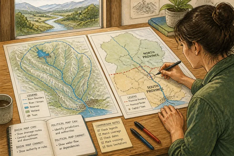
Then write down what each map can support and what it cannot. A basin map can indicate a shared drainage route; a political map can identify jurisdiction. Neither alone establishes water quality, access, allocation or the history behind a boundary.
Read crossings carefully
Say you have two invented maps of a valley. The basin map shows a reservoir in North Province, a river flowing south, and a town in South Province; the political map marks the boundary between the provinces across that route. First, check the legends to confirm that the basin map represents surface drainage and the political map shows provincial lines. Next, trace the river from reservoir to town and mark where it crosses the provincial boundary. The resulting comparison supports a limited answer: the reservoir and town are connected by a mapped surface-water route, and different provincial jurisdictions cover them. It does not tell you how much water reaches the town, what either province has decided, or whether residents can access the river.
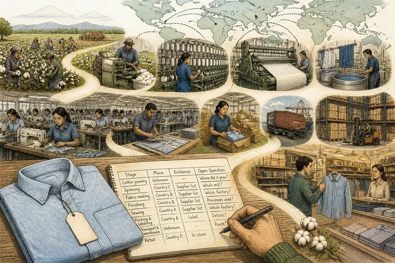
That distinction matters beyond cartography. Water, food production, transport and livelihoods can connect places across administrative borders, while each place remains subject to its own institutions. A map comparison makes the shared landscape legible; it does not replace the local knowledge and governance records needed to understand how those links affect people.
Check scale and omissions
A broad regional map may show a basin outline and major tributaries while omitting small streams, canals or local boundaries. A detailed local map may show those features but offer little context about where the drainage network begins or ends. Choose a scale that includes the details your question needs, then check the legend, date and stated purpose.
A thick border can dominate a thin stream on the page, even when the stream matters more to your question. Conversely, a basin map can make a river system look unified while saying little about the different rules and institutions within it. Maps are models, not neutral windows.
Use omissions as prompts rather than filling them with guesses. A basin outline does not show who can access a riverbank, and a political line does not show how much water reaches a community. Questions about access, water quality or allocation call for other information, such as land records, water-management documents or relevant local observations.
Which map answers which question?
What is the difference between a watershed and a river basin?
The terms often refer to land draining towards a shared outlet, though usage can vary by region and mapmaker. Check the map’s own definition before comparing maps made for different purposes.
Can a river basin cross a national border?
Yes. A basin follows drainage, so it can cross national and subnational boundaries. A political map helps identify which jurisdictions overlap that shared physical system.
Which map should I use to understand a river?
Use a basin map to trace drainage connections and a political map to locate authority. If your question concerns both water movement and responsibility, compare them.
Does a watershed boundary show where all water goes?
No. It indicates a likely surface drainage divide, not every route water takes. Groundwater, storage and human infrastructure can complicate the picture, depending on the place and map’s scope.
Choose the view deliberately
Start with a basin map when you need to understand how places share a water system, and a political map when you need to locate authority. For questions involving both, a river basin or political border comparison helps trace connections alongside responsibility. Keep the maps’ scale, dates and definitions in view; the boundary where they meet is a useful place to ask who depends on the same landscape and who has authority over each part.